 |
| (Invest 99L) |

Nov 22, 2011
DAY 174
With just 9 days left in the 2011 Hurricane Season, Tammy is looming in the North Atlantic. A low pressure system has developed a very healthy surface circulation and has been designated Invest 99L. The National Hurricane Center in giving it a 60% chance of becoming a named sub-tropical system within the next 48 hours. The convection is being push off of the center by some strong southwesterly wind sheer at the moment. It is also about to move north of 30N, which means the water temperatures will no longer be favorable for development. Despite these adversaries, there is strong support from the computer models for 99L to at least develop in to Sub-Tropical Storm Tammy. The chance of this system actually transitioning into a tropical classification has got to be very low given the water temperatures out there. Invest 99L's best chance of development will probably be tomorrow. If it misses that chance, I figure that conditions will become far less favorable as it moves to the northeast.
Nov 11, 2011
DAY 163
Tropical Storm Sean has now merged with that trough and has gone post tropical. The satellite picture below was the last discernible image of Sean. You can see the boundary were the cold front and the western edge of Sean met, and the surface swirl with its convection sheared to the east. Sean picked up his pace to above 30 mph and is racing off to the northeast towards Newfoundland. With just 19 days left in the 2011 Hurricane Season, we have 3 names left, and are 1 storm away from matching last years number at T. The GFS shows some hint of organization but no solid leads for the coming week. This might be it people.
 |
| (Tropical Storm Sean) |
DAY 162
Tropical Storm Sean was unable to reach hurricane strength today and he is now out of time. He is moving into the cold waters of the north Atlantic and he has also received a pretty good first punch from the front of a trough sweeping off of the US east coast. You can see the flat line move across the visible satellite loop below from east to west. The upper portion of the storm is being pushed away first. This trough will eventually consume Tropical Storm Sean and pull his remnants north towards the other low. Sean's center still remains in tact for the most part tonight. He is even still maintaining sustained winds of 65 mph. The NHC is forecasting Sean to last another 8 hours as he brings tropical storm conditions to Bermuda. He may be able to survive until tomorrow afternoon, but we will soon close the book on the 18th tropical cyclone of the season.
 |
| (Tropical Storm Sean) |
Nov 9, 2011
DAY 161
Tropical Storm Sean has made his move to the north and has picked up his pace to a whopping 8 mph. Sean was also able to strengthen to a 65 mph sustained storm today. The tightening that was seen from the visible satellite during the day, started to open back up after the sun set. This doesn't look like a storm that is about to become a hurricane, but he certainly will have a shot. The Hurricane Center is giving Sean about a 50/50 chance right now, but they are leaning towards Sean becoming a hurricane tomorrow night. If he is able to pull this off, Sean would become our 7th hurricane of the season.
 |
| (Tropical Storm Sean) |
DAY 161
Sean has apparently had no problem transitioning from a sub-tropical structure to a tropical storm. He is now relying on warm moist air from sea surface evaporation to fuel his circulation. The NHC is forecasting Sean to remain a tropical storm for 2 more days, as he gets swept up to the north. Once he gets above 30N, the ocean surface temperature will no longer be able to support the growth of a tropical cyclone, and Sean will begin to die. He will have a very difficult time gaining much more strength before then, although the NHC is giving Sean good odds of topping out at a 65 mph tropical storm on Thursday. He is going against the grain right now, once he turns to the north, upper level winds will become more favorable, and he will also be moving away from the bulk of dry air. Sean may bring Bermuda some moderate effects on Thursday night.
The Mediterannean Storm that the US Navy has identified as Invest 99L is about to make landfall in the French Riviera. It will likely bring tropical storm force sustained winds and heavy rainfall to that area.
 |
| (Tropical Storm Sean) |
 |
| (Time Lapse of Invest 99L) |
Nov 8, 2011
DAY 160
Invest 98L is on the verge of becoming Sub-Tropical Storm Sean. It is located about 460 miles southwest of Bermuda, and has been drifting slightly westward throughout the day. The National Hurricane Center is giving it a high probability of developing into a sub-tropical cyclone in the next 48 hours at 80%. Invest 98L is in a battle with dry air which pretty much surrounds it. There is also some southwesterly shear. This storm is expected to move very slowly to the west if not remain stationary for a couple of days before being swept of to the north by a trough. This storm will likely never impact any landmass nor become fully tropical.
Also in the Sub-Tropics, there is a rare storm brewing in the Mediterranean Sea. Even though this is an Atlantic Invest, this will not receive an Atlantic name if it develops, nor is the NHC responsible for issuing warnings on it. Storms so rarely develop in the Mediterranean that none of the worlds meteorological organizations claim the area.
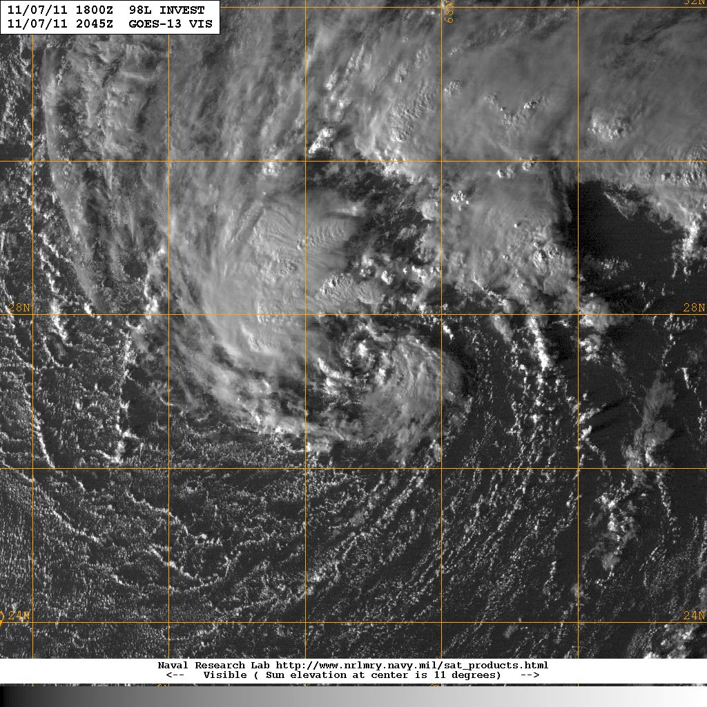 |
| (Invest 98L) |
Also in the Sub-Tropics, there is a rare storm brewing in the Mediterranean Sea. Even though this is an Atlantic Invest, this will not receive an Atlantic name if it develops, nor is the NHC responsible for issuing warnings on it. Storms so rarely develop in the Mediterranean that none of the worlds meteorological organizations claim the area.
 |
| (Invest 99L) |
Oct 29, 2011
DAY 150
Rina died almost as fast as she was born, as the trough diving down into the Gulf has severed her in half. The mid-level portion of Rina was drawn up to the northeast and is making a rainy impact on south Florida. While her remnant surface low moved off to the ESE and is about to collide with a tropical wave. The NHC is giving that wave a 10% chance of developing into a tropical cyclone in the next 48 hours. The GFS is keeping low pressure in the Caribbean all next week, and is hinting at more development. The area remains active but also hostile.

Subscribe to:
Posts (Atom)